History
The settled area of Smith, Alberta first laid just north of the current hamlet site. Called Mirror Landing, in the late 19th century was a stopping point along a trail for travellers to the Peace Country from Fort Edmonton via Athabasca Landing. By 1911, Mirror Landing was one of numerous stopping points for unimpeded steamboat travel between Athabasca Landing and Lesser Slave Lake.
The community was incorporated as the Village of Fort Cornwall on October 27, 1913, although it was referred to as Port Cornwall as early as January 1914.
By early 1914, the village had over 30 businesses and numerous residences. Infrastructure included streetlights and sidewalks. It also included a government telegraph office and quarters for the Royal Northwest Mounted Police. At this time, plans were also underway for the building of a school and a Methodist church.
However, early 1914 would also spell the beginning of the end for the village. The Edmonton, Dunvegan and British Columbia Railway had reached the present location of Smith, across the confluence of the Lesser Slave and Athabasca rivers from Port Cornwall. Subdivision of the Smith townsite began as a result, and Port Cornwall's demise began. Ultimately, the Village of Port Cornwall later disorganized on September 11, 1917.
Source: www.wikipedia.org
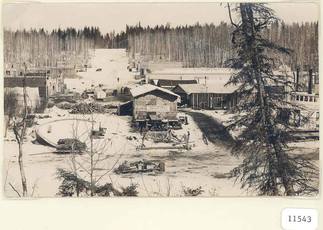
Photo from the Athabasca Archives of Mirror Landing
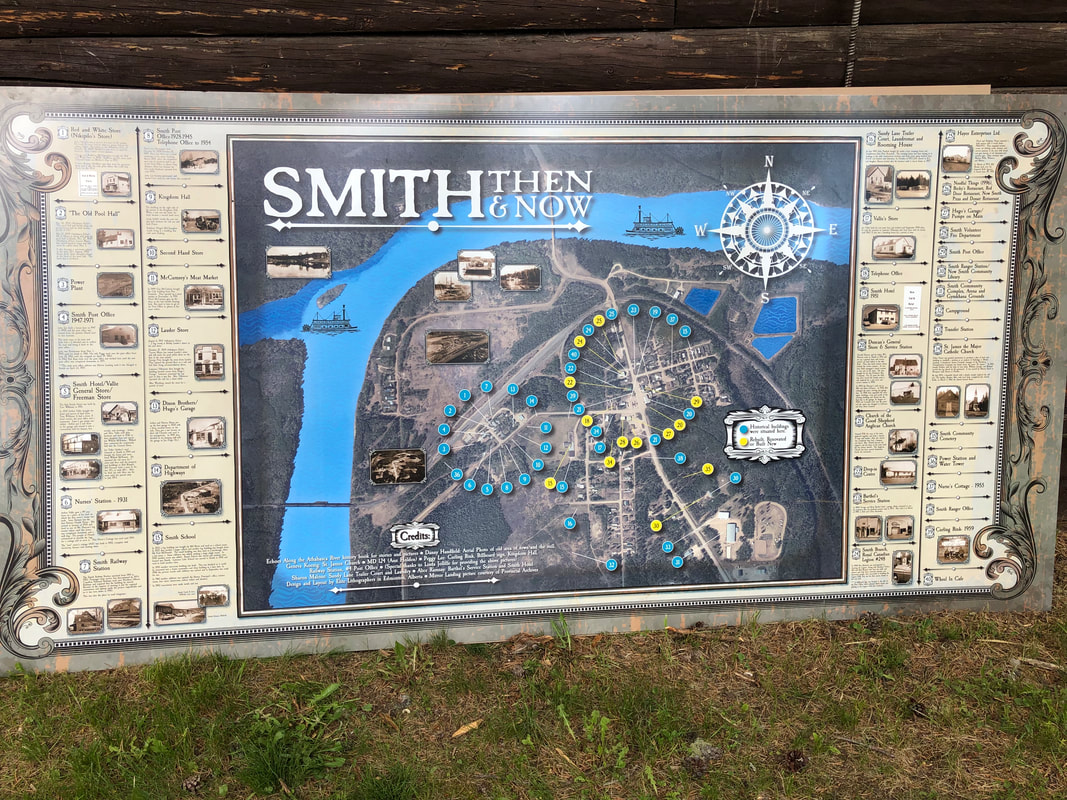
A map, Smith Then and Now, (see below) has been created depicting where historical buildings were located and a bit about their histories. Present day buildings and businesses are also located on this map which is located on the fence in the park.
Interested in Smith (Mirror Landing) history?
Check out the Mirror Landing & Beyond Facebook Page
The history book, Echoes Along the Athabasca River, about this area and families can be read at the Smith Community Library.
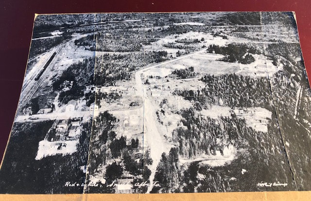
An enlarged map circa 1957, taken from a calendar from the Red and White Store in Smith.
Smith Community Cemetery: Veterans
| smith_community_cemetery.military..docx |

Historical Buildings
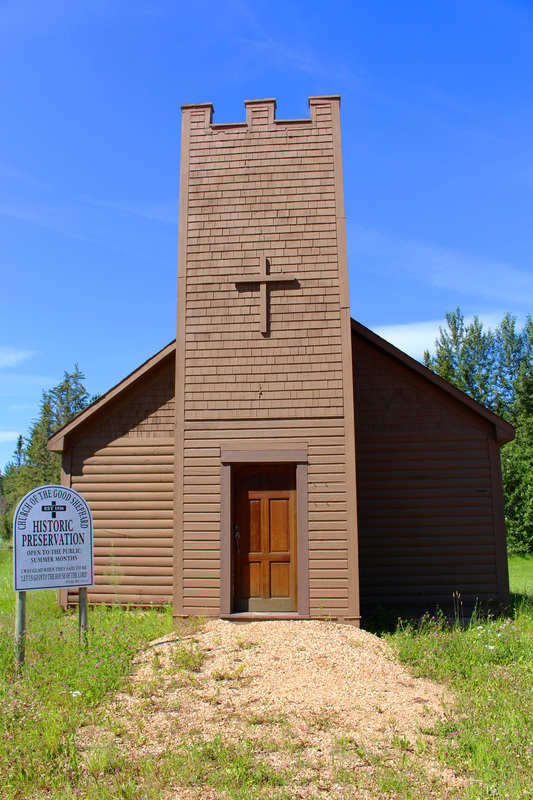
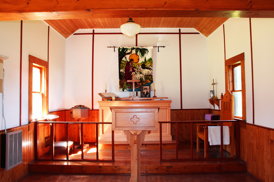
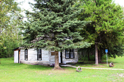
The Church of the Good Shepherd (Anglican Church) holds many fond memories for locals and visitors alike. It seems that everyone knows someone who was baptized or married there. It has been moved next to the Smith Pizza & Donair Restaurant on Main Street.

Little White Church (as known by locals) in Hondo.
Heritage Schools
|
| ||||
|
| ||||
|
| ||||
|
| ||||
| sunshine_valley.moose_portage.pdf |
